| | => Beuzec-Cap Sizun
(29) |
KM: 12 | CARTE: IGN 13 |
| DE | D43, links 3 Km nach Goulien, rechts in D7 | Kapelle in Lézouac’h, Kapelle St Laurent, Kirche mit Lec’hs |
| EN | D43, left 3 Km after Goulien, right in D7 | Chapel of Lézouac’h, chapel St Laurent, church with lec’hs |
| FR | D43, à gauche 3 Km après Goulien, à droite dans
D7 | Chapelle de Lézouac’h, chapelle St Laurent, église avec lec’hs |
| IT | D43, a sinistra 3 Km dopo Goulien, a destra in
D7 | Cappella di Lézouac’h, cappella St Laurent, chiesa con lec’hs |
| |
||||
| Plogoff - Le
Faou |
| | Strecke |
Itinerary |
Itinéraire |
Itinerario |
| |
| |
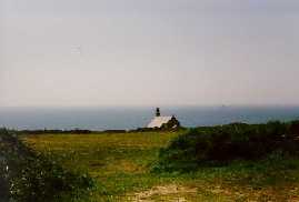
| | => Pointe du Van
(29) |
KM: 6 | CARTE: IGN 13 |
| DE | Zurück zur D7, links |
Kirche und Brunnen St They, Pointe du Van, Sicht zum Leuchtturm Tévennec |
| EN | Back to D7, left | Church
and fountain St They, Pointe du Van, sight to the lighthouse of Tévennec |
| FR | Revenir sur D7, à gauche | Eglise et fontaine St They, Pointe du Van, vue sur le phare de Tévennec |
| IT | Ritornare sulla D7, a sinistra | Chiesa e fontana St They, Pointe du Van, vista sul faro di Tévennec |
| |
||||
| Châteaulin -
Plogoff |
| | Strecke |
Itinerary |
Itinéraire |
Itinerario |
| |
| |
||||
| Rennes -
Pointe du Raz |
| | Strecke |
Itinerary |
Itinéraire |
Itinerario |
| |
| |