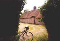
=> Le Coudray (44)
KM: 17
CARTE: IGN 24
|

Le Gâvre - Redon - Le Gâvre
|
Lorient - Vannes - Redon - Nantes
|
Redon - St Malo
=> Masserac (44)
KM: 7
CARTE: IGN 24
|
Redon - St Malo
=> Le Coudray (44) |
KM: 17 | CARTE: IGN 24 | ||||
| DE | Links in D131, weiter bis kurz nach Le Saint | |||||
| EN | Left in D131, continue until short after Le Saint | |||||
| FR | A gauche dans la D131, continuer jusque peu après Le Saint | |||||
| IT | A sinistra nella D131, continuare fino poco dopo Le Saint | |||||
| Le Gâvre - Redon - Le Gâvre | |||||
| Strecke | Itinerary | Itinéraire | Itinerario | |||
| Lorient - Vannes - Redon - Nantes | |||||
| Strecke | Itinerary | Itinéraire | Itinerario | |||
| Redon - St Malo | |||||
| Strecke | Itinerary | Itinéraire | Itinerario | |||
=> Masserac (44) |
KM: 7 | CARTE: IGN 24 | ||||
| DE | D46 | Lac de Murin, Tal des Don | ||||
| EN | D46 | Lac de Murin, valley of the Don | ||||
| FR | D46 | Lac de Murin, vallée du Don | ||||
| IT | D46 | Lago de Murin, valle du Don | ||||
| Redon - St Malo | |||||
| Strecke | Itinerary | Itinéraire | Itinerario | |||
Codewriter: Visual Basic Application - Programmed by : Marzina Bernez
Webdesign, Contents & Copyright : Marzina Bernez - Version : 03.03.2008
URL http://marzina.free.fr/GEO26.html